Project Management
The system provides a clear overview for managing projects and folders. The main view includes list and card layouts, quick filters, a search bar, and project and folder operations.
✅ Advantage
Flexible views and quick filters make it easy to search and organise even large numbers of projects.

Key Features
- Create project: start a new processing project by entering a few basic details.
- Create folder: create thematic containers for organising projects. Ideal for scheduling multiple surveys of the same area over time.
- Switch view: choose between list or card view.
- Filter and search: quick filters by location, type, and status + full-text search.
Views
List View
Columns: Name, Location, Photo/LiDAR (data source type), Created, Status, Actions.
All key commands are accessible from the actions menu at the end of each row.
Clicking on a project row opens the project page.
Card View
Project basics are prominently displayed (description, location, role, type, creation date), with a status badge in the header.
An open button at the bottom of the card navigates to the project page.
Filtering and Search
- Quick filters: Location, Type, Status (multiple conditions can be combined).
- Search: by name and additional metadata.
- Filter persistence: applied filters are retained when switching between views.
Statuses
- Planning: project is under preparation
- Processing: data processing is in progress
- Report ready: all results and reports are available
Project and Folder Operations
The menu on the right side of each row/card:
- Details: open the project's detail page (results, visualisations, files).
- Share: share with users and set permissions.
- Move: move the project to another folder.
- Edit: modify basic data (name, description, type, etc.).
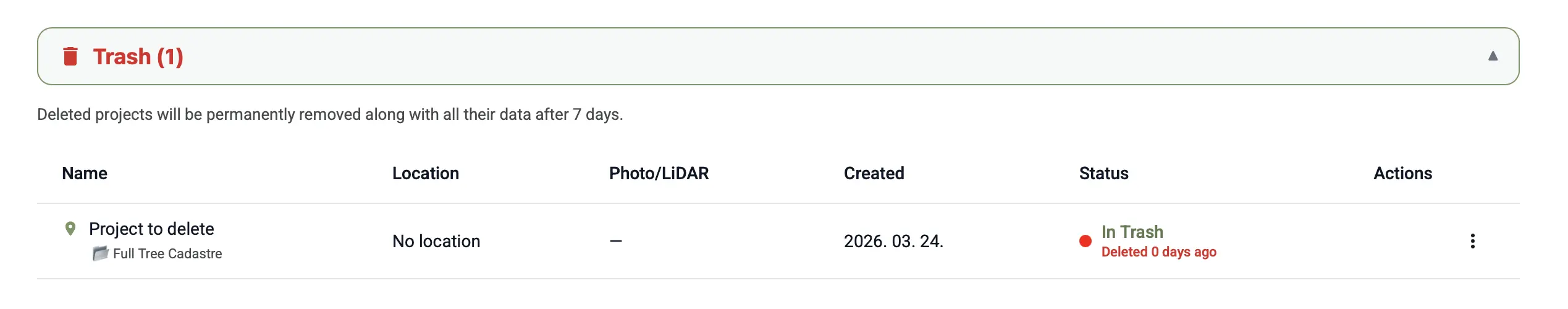
- Delete: the project is moved to the Trash folder, where it can be restored or permanently deleted within 7 days. After 7 days, the project is automatically and irrevocably deleted.
⚠️ Warning
Projects permanently deleted from the Deleted folder, or automatically removed after the 7-day period, cannot be restored.
Data Source Type
- LiDAR: processing based on georeferenced point cloud.
- Photo: point cloud generated from photogrammetric processing.
The type is displayed in both list and card view, giving a quick overview of the project technology.