Tree Count
The Tree Count service automatically determines the exact number and spatial distribution of trees within a surveyed forest area.
Processing is available for both LiDAR and photogrammetry data, in leaf-on and leaf-off conditions alike.
The system identifies individual trees from the uploaded point cloud or image-based model, and assigns each one georeferenced coordinates.
The result is an accurate, verifiable forest stand map.
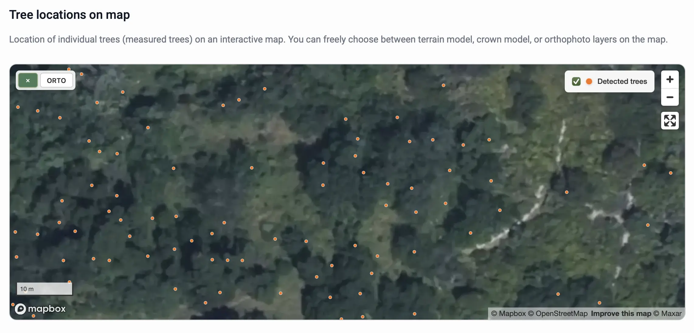
Output
The processing results include:
- Total stem count for the selected area
- Spatial positions of individual trees in
.xlsxformat - Visualised tree distribution displayed on an interactive map
✅ Advantage:
Tree counting is a fast, fully automated process that can be performed regardless of whether the survey was conducted in leaf-on or leaf-off conditions.