Services Overview
TreeDetect supports two data processing technologies: LiDAR and photogrammetry.
Both can be used to automatically generate a complete forest survey.
- For LiDAR, processing is based on the uploaded point cloud.
- For photogrammetry, processing is based on aerial images. The system first creates a precise 3D point cloud using photogrammetric methods, and then performs analyses on it. Thanks to the photos, a detailed orthophoto can also be generated.
✅ Advantage:
Whether you upload a point cloud or images, TreeDetect automatically processes the data and produces a detailed, visually interpretable forest report.
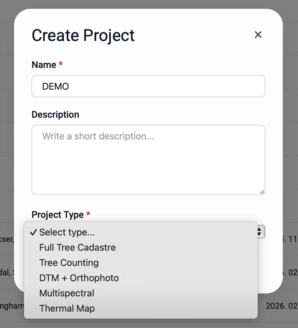
Processing Types
When creating a project, the user can select the type of processing to be performed on their data. This determines what kind of output results and visualisations will be generated for the survey area.
Services and Outputs
The table below presents TreeDetect's core services.
| Service | Description | Output / Notes | Availability |
|---|---|---|---|
| Complete Tree Inventory | The system automatically identifies every individual tree and measures its height, trunk diameter, crown diameter, volume, and location. | Detailed tree inventory table (exportable as .xlsx) | Only available with photogrammetry in leaf-off conditions |
| Tree Count | Automatic detection and counting of trees in the forest area based on point cloud or image-based model. | Total stem count and spatial distribution | Available for both LiDAR and photogrammetry |
| Digital Terrain Model (DTM) + Orthophoto | A georeferenced model showing the elevation of the ground surface, along with an aerial image of the area generated from drone footage. | Downloadable terrain model and orthophoto in .tif format | Can be produced with photogrammetry in both leaf-on and leaf-off conditions |
| Multispectral Processing | Generates a multispectral layer of the area from multispectral imagery; the scale and indices are adjustable in the interface. | Interactive multispectral map layer | Only for data captured with a compatible multispectral sensor |
| Thermal Map (Heat Detection) | Creates a thermal orthophoto and detects heat signatures within a defined temperature range (typically 30–40 °C for wildlife surveys). | Thermal orthophoto layer and map-marked detected heat points | Only available for data captured with a thermal camera |
⚠️ Warning!
The Complete Tree Inventory service is only available with photogrammetry for data captured in leaf-off conditions.
During the growing season, the canopy layer may obscure trunks, preventing accurate measurement.
🌲 Tip:
Using LiDAR enables more accurate, individual tree-level analysis, while photogrammetry also produces an orthophoto.