Heat Detection
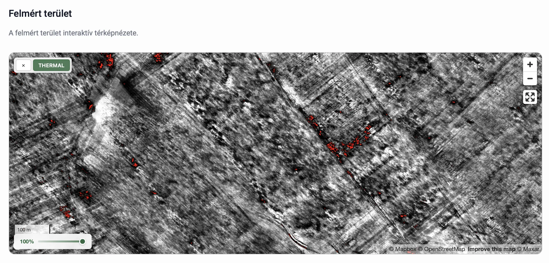
The Heat Detection service creates a comprehensive thermal orthophoto of the surveyed area from thermal camera imagery.
Based on this, the system automatically detects heat signatures within a predefined temperature range (typically 30–40 °C, commonly used for wildlife surveys).
Output
The processing results include:
- A thermal orthophoto in
.tifformat, providing a comprehensive heat map of the area. - A map visualisation where detected heat signatures are marked with coloured dots.
✅ Advantage:
The thermal orthophoto combined with automatic temperature range-based detection provides an efficient solution for rapid wildlife population surveys.