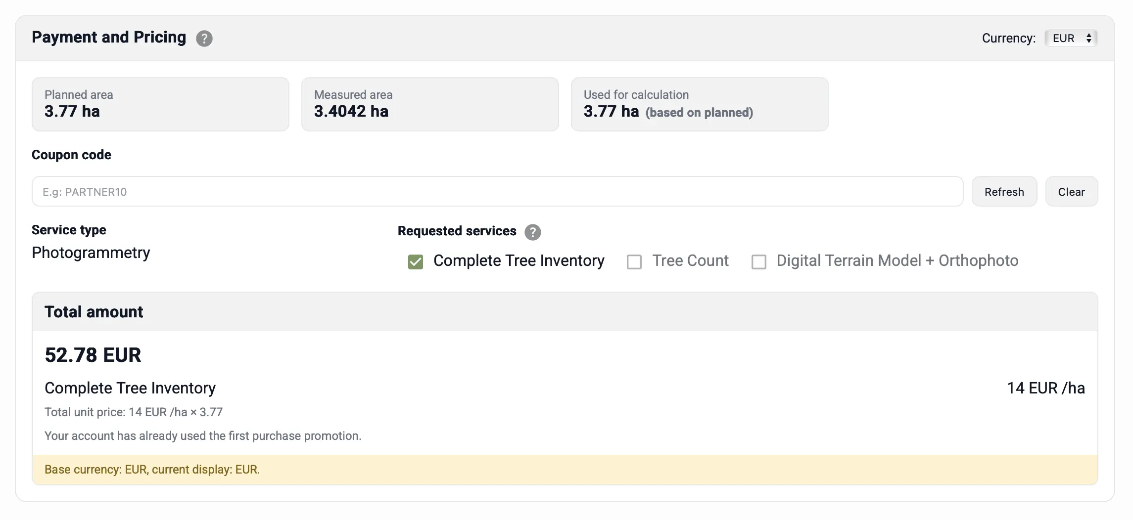
Payment and Area Calculation
TreeDetect operates on a pay-as-you-go basis. You only pay for the area you actually survey.
The area size is calculated from two mutually verifying sources:
- Planned area: based on the polygon(s) drawn on the map in the planning section.
- Surveyed area: estimated coverage derived from the uploaded raw materials (image geometry, LiDAR point cloud footprint).
Area Comparison
The system automatically compares the two values:
- By default, the smaller area (planned area) is used as the basis for payment.
- If the difference is ≥ 10%, the actual (material-derived) value is used instead (in cases of significant deviation, this better reflects the actual volume of work done).
The area currently being used for calculation is highlighted separately in the payment panel.
What You See in the Payment Panel
- Planned area (ha): total area of the polygon(s) drawn on the map.
- Surveyed area (ha): estimated coverage based on the uploaded files.
- Difference: the percentage difference between the two values.
- Area used for calculation: the value selected based on the rule above.
- Service type: Photogrammetry or LiDAR.
- Requested services: Complete tree inventory, Tree count, Digital Terrain Model.
- Currency: the chosen currency.
- Total: unit price (HUF/EUR/USD per ha) × area used for calculation, with any applicable discounts.
✅ Advantage: The dual-source area calculation (planned + actual coverage) provides a transparent and fair billing system, while protecting users from the effects of accidental oversurveying or under-coverage.