Flight Parameters
On the TreeDetect interface, the user can specify which drone will be used for the survey, and based on this, the software provides the recommended flight parameters for optimal data collection.
Two data collection modes are available: Photogrammetry or LiDAR.
The interface automatically adapts the parameter input to the selected method.
Supported Drones and Cameras
TreeDetect is compatible with the most widely used drones and cameras suitable for forest surveys. A selection of drones can be chosen from the list available on the platform.
Photogrammetry Flight Parameters
- Flight altitude (m): depends on the camera resolution (e.g., 80.0 m)
- Frontal overlap (%): forward overlap between consecutive images (e.g., 90%)
- Side overlap (%): lateral overlap between flight lines (e.g., 85%)
- Gimbal angle (°): camera tilt angle (e.g., -65°)
- Terrain following: the drone automatically follows the terrain contour (ON/OFF)
- Flight pattern: the type of flight path (e.g., 2-way crosshatch)
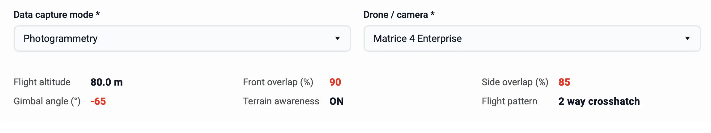
✅ Advantage: High overlap and the correct camera angle ensure that images produce an accurate 3D point cloud and orthophoto.
LiDAR Flight Parameters
- Flight altitude (m): depends on the sensor resolution (e.g., 80.0 m)
- Side overlap (%): lateral overlap ratio (e.g., 60%)
- Gimbal angle (°): LiDAR sensor tilt angle (e.g., -60°)
- Terrain following: the drone automatically follows the terrain contour (ON/OFF)
- Flight speed (m/s): drone speed during the survey (e.g., 4.5 m/s)
- Flight pattern: the type of flight path (e.g., 2-way crosshatch)
- Return mode: number of return pulses recorded (e.g., 5)
- RGB colour: generate coloured point cloud (ON/OFF)
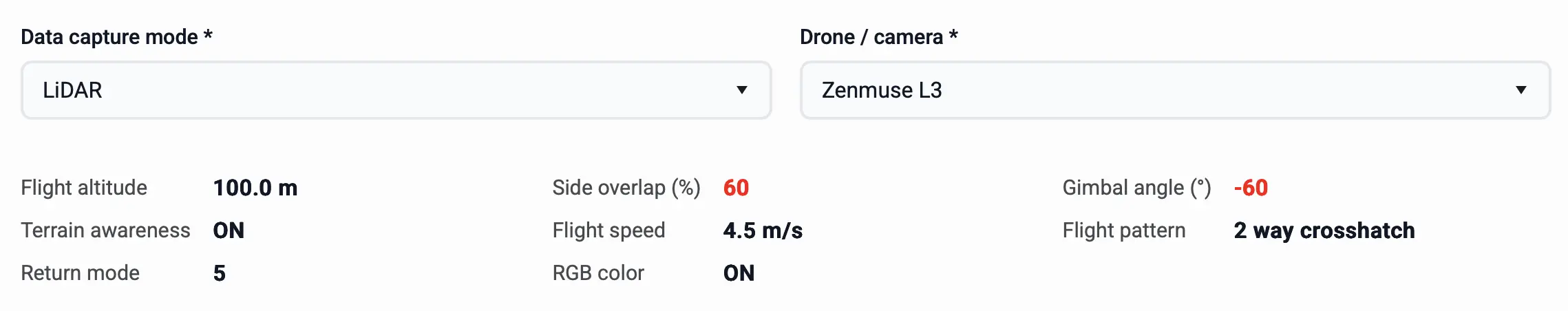
✅ Advantage: A point cloud captured with a LiDAR sensor provides detailed representation of tree canopies and the ground surface, enabling more accurate terrain and stand modelling.
⚠️ Warning: The quality of data collection is the responsibility of the pilot. Always use the parameters recommended by the software to achieve the desired results!